Hawkeye
Hawkeye is a location management system for companies with field teams. It shows where every field worker is on a live map, lets managers set up smart rules for tracking, and turns movement data into alerts, history and shareable reports.
Knowing where your people are should not take a phone call. Hawkeye puts the whole field team on one map and lets the system watch for what matters.
Starting point. Operations managers told me they spent hours each day calling workers to check on them, and still learned about missed visits or unsafe situations too late. The design focuses on three jobs: see where people are now, get alerted automatically, and review what happened later.
Entities
Every worker is an “entity”: a person and their device. The map is always the main stage, with the list of people on the side.
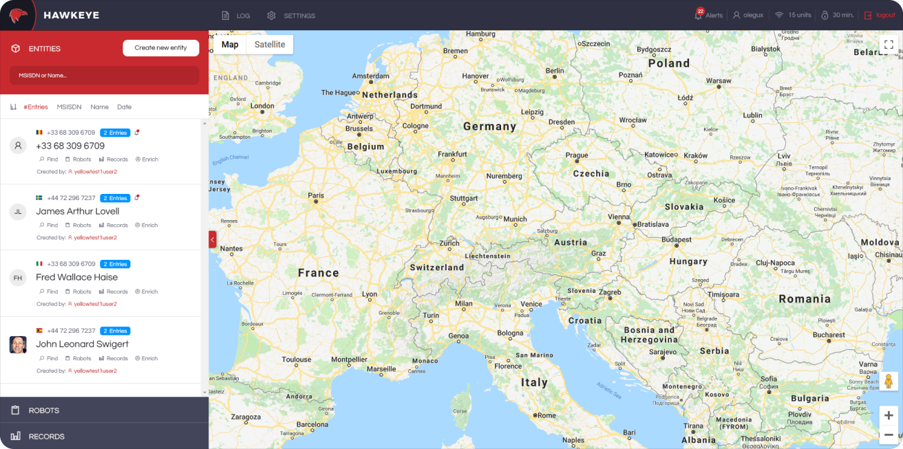
Entities on the map. A searchable list of workers with their phone number, country and number of entries, next to a full-screen map. From each card a manager can find the person, attach a robot, open their records or enrich the profile.
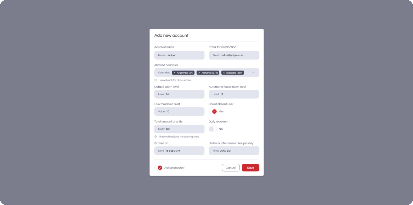
Accounts. Admins add new users and decide what each one can see and do, in a simple form inside Configuration.
Robots
Robots are rules that watch the map for you. Instead of checking on people, managers set up a robot once and Hawkeye reports back.
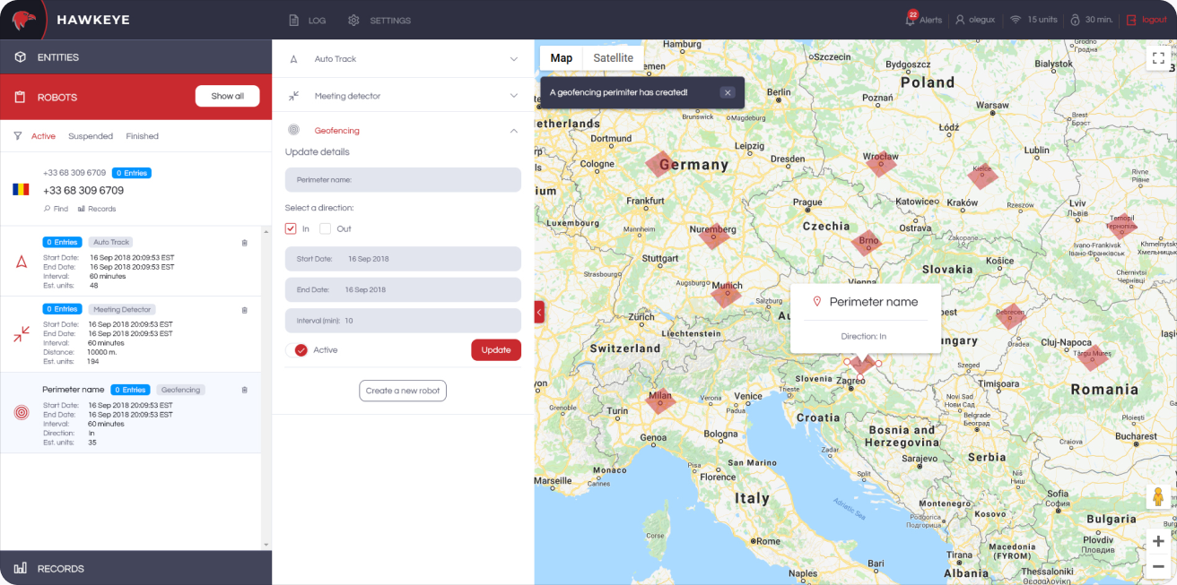
Geofencing. Draw a perimeter, choose whether to watch for workers coming in or going out, set the dates and interval, and the robot starts working. Active, suspended and finished robots are listed by type: auto track, meeting detector and geofencing.
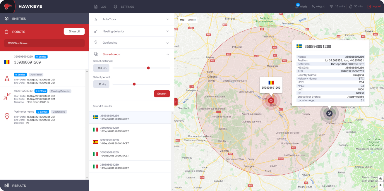
Shared areas. Find everyone who was inside a chosen radius during a chosen period. Results appear as a list and as markers on the map, each with time, network and location details.
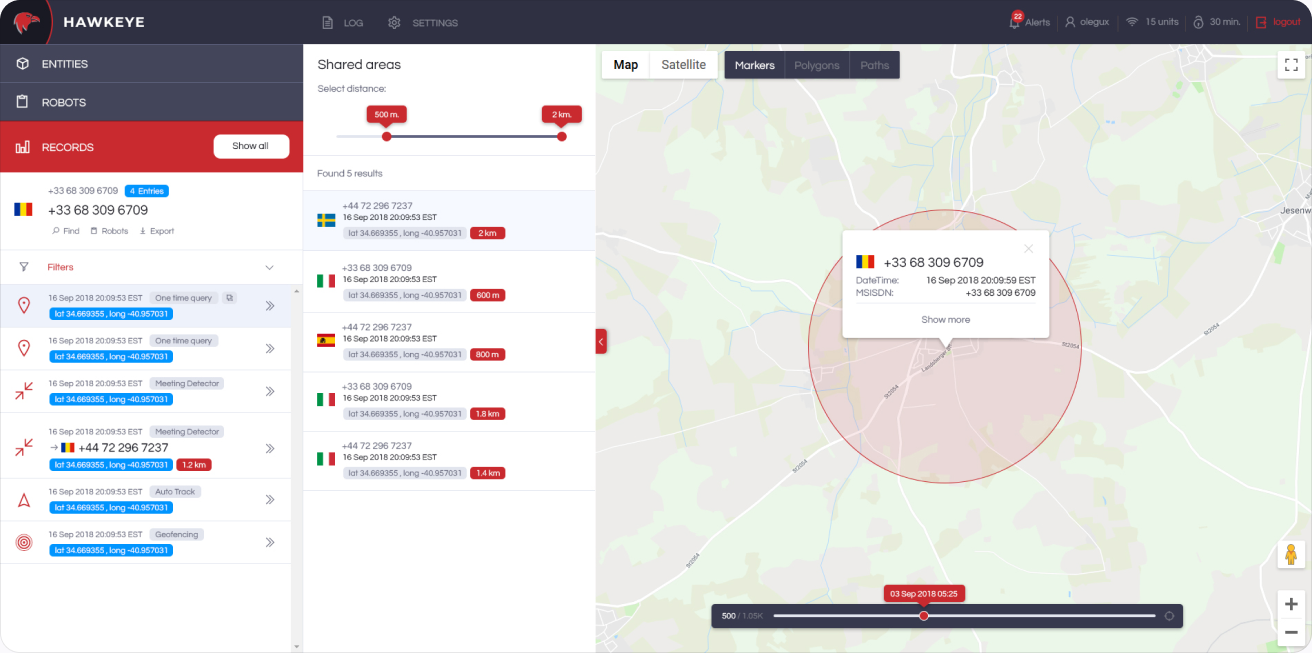
Results, shared areas. Every result can be opened on its own, showing the exact position, accuracy circle and the full record behind it.
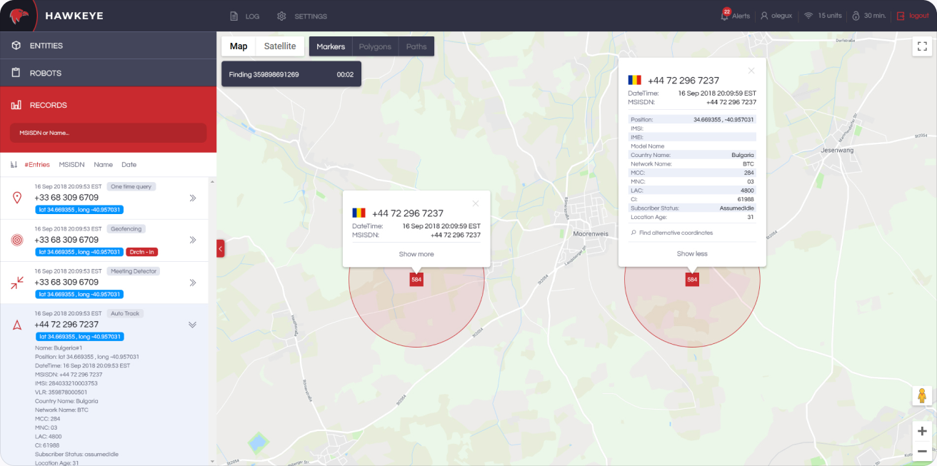
Results, show all. All results of a robot on one map at once, so patterns and clusters become visible.
History & alerts
What happened, and what should happen next time. History looks back; alerts look ahead.
History. A timeline of every location record for a worker, filterable by date and type, with the route drawn on the map.
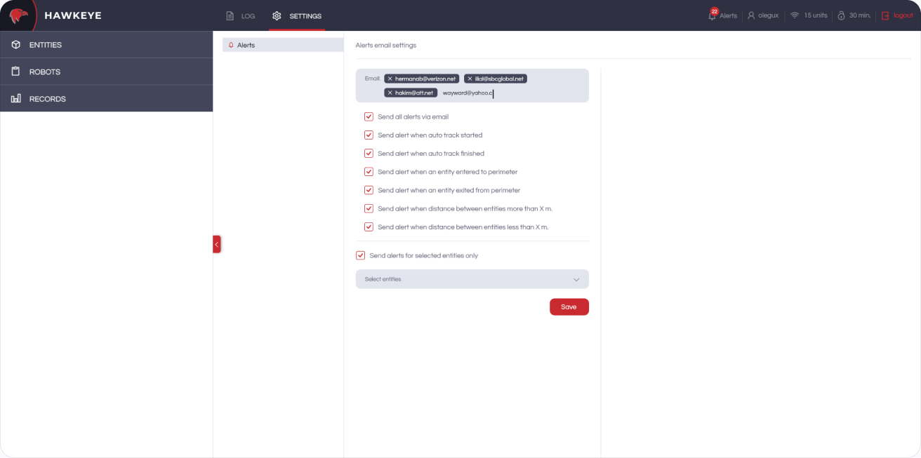
Alert settings. Choose who gets emails and when: tracking started or finished, entering or leaving a perimeter, or two workers getting too close or too far apart, for all entities or only selected ones.
Reports
Some answers need to leave the screen. Hawkeye exports any worker’s movements as a clean, printable report.
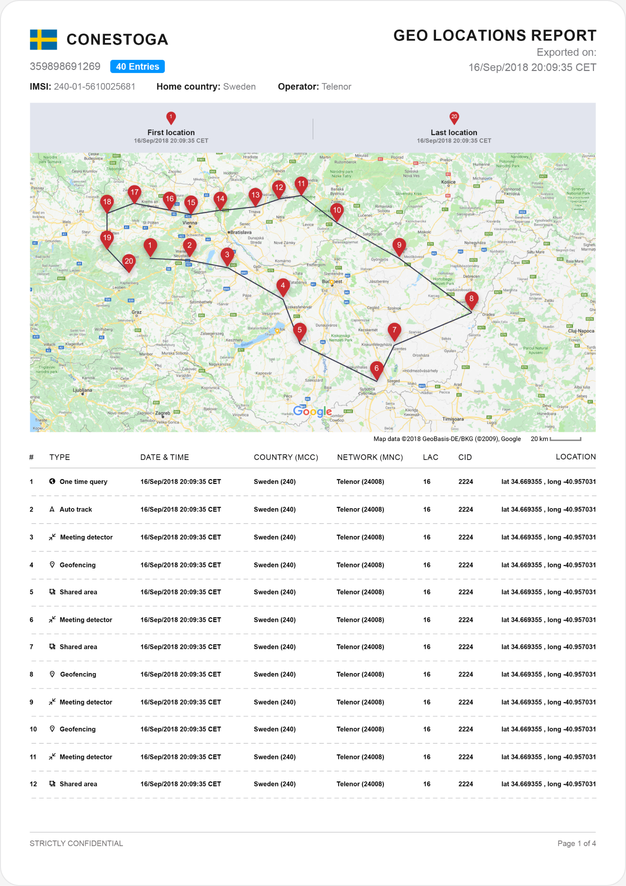
Geolocation report. A multi-page PDF with the worker’s details, first and last location, a numbered route on the map and a table of every record: type, date and time, country, network and coordinates.